Infrastructure Mapping Application
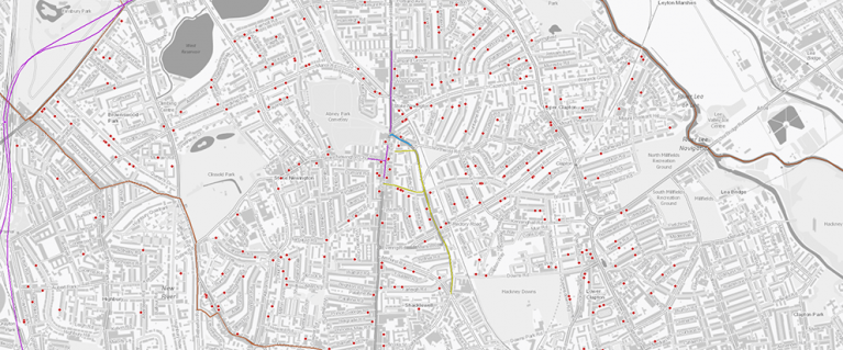
The London Infrastructure Mapping Application (IMA) is an interactive web-based mapping tool that displays growth and development data, future infrastructure investment data, and contextual information relating to growth and infrastructure in Greater London.
A public version of the IMA is here.
Key Features:
- Collaboration Tool: This tool automatically identifies streetworks schemes which overlap in space and time
- Probability of Development: The IMA models and visualises the likelihood of residential construction projects to be delivered as expected by a specified date
- Dormant Sites Filter:The IMA can filter out residential projects that haven’t completed a new unit for a specified number of years
- Area Summarisation and Data Visualisation: The IMA can summarise the scale, scope and status of infrastructure and construction projects happening in a specified area to build understanding and improve usability
The IMA has 25,000 data points and over 50 context layers which are regularly updated as we incorporate new datasets sourced directly from industry and public sector partners.
The data in the IMA broadly falls into three categories:
- Future infrastructure investment data, from six months to 30 years into the future. There is an understanding among users that this data is inherently speculative
- Growth and development data from the Planning London Datahub (PLD)
- Relevant contextual data
The IMA is funded by Lane Rental and is a core tool for the delivery of the Coordination Service, particularly the following two service lines:
- Streets: The IMA searches for overlaps in space and time between works promoters’ future investment data to identify opportunities for coordinated streetworks
- Planning of infrastructure: Development data (actual and modelled) in the tool supports infrastructure providers, developers and the public sector better plan for growth enabling timely housing delivery
Facilitating data exchange across the infrastructure sector benefits both infrastructure providers and the public. The IMA benefits utilities, transport providers, Londoners and the public through:
- Cost savings through the avoidance of repetitive road resurfacing
- Collaborative streetworks result in less road network disruption, noise and access issues
- Sustainable growth
- Improved resilience of infrastructure networks by understanding interdependencies
The IMA contains a mixture of data - some is publicly accessible, and some is sensitive and can only be viewed on a password-protected private site. This allows us to respect constraints around releasing sensitive information publicly. Both versions are currently free of charge.
A link to the public site is here.
The private site is password protected and accessible only to organisations who have signed a NDA, agreeing to use the data only for certain purposes and with agreed users. Only local authorities, infrastructure and transport providers can sign the NDA and it’s not accessible to commercial organisations, though options are being explored to provide access for telecoms. If you would like to access the private IMA please get in touch to find out more about the NDA process and the permitted use of the data.
You can email us at [email protected]
Need a document on this page in an accessible format?
If you use assistive technology (such as a screen reader) and need a version of a PDF or other document on this page in a more accessible format, please get in touch via our online form and tell us which format you need.
It will also help us if you tell us which assistive technology you use. We’ll consider your request and get back to you in 5 working days.