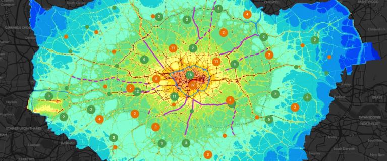
London air quality map
This map shows the locations of air quality monitoring stations across London and the areas covered by Google Street View cars fitted with mobile air quality sensors.
It also features the Mayor's actions to tackle air pollution including the Ultra Low Emission Zone, Low Emission Bus Zones, rapid charge points and schools and nurseries that were a part of the Mayor's audit programme.
You can also view air quality data with Nitrogen Dioxide (NO2) levels from 2019 and projected levels for 2025 following the Mayor's actions as set out in the London Environment Strategy.
Need a document on this page in an accessible format?
If you use assistive technology (such as a screen reader) and need a version of a PDF or other document on this page in a more accessible format, please get in touch via our online form and tell us which format you need.
It will also help us if you tell us which assistive technology you use. We’ll consider your request and get back to you in 5 working days.